Learn Where’s Egypt located and see why its position has drawn explorers, traders, and travelers for thousands of years. At first glance, it may seem simple, but Egypt lies at a crossroads of Africa and Asia, surrounded by iconic landscapes. From the Nile Valley to the Red Sea coast, its location defines everything. Here, you’ll discover exactly where Egypt is and why it’s so important to understand before you visit.
Where Is Egypt
If you’re wondering Where Is Egypt, the answer is both simple and fascinating. Egypt is a country located in the northeastern corner of Africa, with a small part extending into Asia through the Sinai Peninsula. This unique position has made it a meeting point between continents for thousands of years.
It sits along the banks of the Nile River, which flows from south to north and creates a fertile strip of land in the middle of vast desert landscapes. To the north, Egypt borders the Mediterranean Sea, while the Red Sea lies to the east, giving the country access to important maritime routes.
Many travelers are surprised to learn how strategic Egypt’s location really is. It connects Africa to the Middle East and has historically been a gateway for trade, culture, and exploration. This is one reason why ancient civilizations flourished here and why it remains a key destination today.
If you visit Egypt, you’ll notice how this location shapes everything—from the climate to the culture. Standing in places like Cairo or near the Nile, you’re not just in one region—you’re at a crossroads of continents and history.
Where’s Egypt located in the world today
Understanding Where’s Egypt located today helps you quickly place it on a modern global map. Egypt sits in the northeastern part of Africa, forming a natural bridge between Africa and Asia through the Sinai Peninsula. This position makes it one of the few countries that physically connects two continents.
In today’s world, Egypt is bordered by the Mediterranean Sea to the north, the Red Sea to the east, Libya to the west, and Sudan to the south. This location places it at the heart of major global routes, especially near the Suez Canal, one of the most important waterways on Earth.
Many travelers don’t realize how central Egypt is until they look at a world map. It lies between Europe, Africa, and the Middle East, making it easily accessible from many regions. This is why flights to Cairo are often direct from major cities across three continents.
Because of this strategic position, Egypt remains a key travel hub. Whether you’re heading to the pyramids, cruising the Nile, or relaxing on the Red Sea coast, its location continues to shape both its history and its modern importance.
Where’s Egypt on the map
If you look closely at a global map, where’s egypt on the map becomes easy to identify once you know what to look for. Egypt appears in the top-right corner of Africa, just below Europe and beside the Middle East. It is positioned along two major bodies of water—the Mediterranean Sea above and the Red Sea to the east—which helps travelers quickly spot it.
One interesting detail is the triangular Sinai Peninsula, which stretches into Asia. This small section often surprises people because it means Egypt is not entirely in Africa. On most maps, you’ll also notice the Nile River cutting through the country from south to north, acting like a natural guide to Egypt’s location.
Most travelers first recognize Egypt by its proximity to well-known regions. It sits just south of countries like Greece and Turkey across the Mediterranean, and west of Saudi Arabia across the Red Sea. This makes it a central point between continents.
When planning a trip, understanding Egypt’s map location helps you see why it has always been a crossroads of cultures, trade routes, and civilizations throughout history.

Where’s Egypt on the world map
On a global scale, Where’s Egypt located becomes much clearer when you view a full world map. Egypt sits at the intersection of three major regions—Africa, the Middle East, and close to Europe—making it one of the most strategically placed countries on Earth.
You’ll find Egypt in the northeastern corner of Africa, directly below the Mediterranean Sea. To its east lies the Red Sea, which separates it from the Arabian Peninsula. This unique placement means Egypt connects continents not just geographically, but culturally and historically as well.
Most travelers don’t realize how central Egypt appears until they zoom out on a world map. It’s almost like a natural bridge linking different parts of the world. This is one reason why ancient trade routes passed through Egypt and why it remains globally important today.
If you’ve ever flown between Europe and Africa or Asia, chances are your route passed near Egyptian airspace. Its location continues to shape travel routes, tourism, and global connections even today.
Where is Egypt Geographically Located?
Egypt is geographically positioned in a unique and strategic part of the world, sitting at the northeastern edge of Africa while extending into Asia through the Sinai Peninsula. This dual-continental presence is what makes Egypt stand out compared to many other countries.
The country is defined by several natural boundaries. To the north lies the Mediterranean Sea, while the Red Sea forms its eastern border. Between these two seas runs the famous Suez Canal, a critical global shipping route. To the west, Egypt borders Libya, and to the south, Sudan. These borders create a clear picture of Egypt as a gateway between regions.
One of the most important geographical features is the Nile River, which flows from the south to the Mediterranean in the north. Nearly all of Egypt’s population lives along this narrow fertile strip, surrounded by vast desert landscapes like the Sahara.
If you explore beyond Cairo, you can really feel this geography in action. For example, during the Alexandria Day Tour from Cairo, you travel from the dry Nile Valley to the fresh Mediterranean coast, experiencing how Egypt’s location shapes its landscapes, climate, and daily life.

Is Egypt in Africa or Asia?
This question often comes up when people explore maps, and the answer connects directly to Where’s Egypt located in the world. Egypt is primarily in Africa, but it also has a small part in Asia, making it a transcontinental country.
Most of Egypt’s landmass, including cities like Cairo, Luxor, and Aswan, lies in northeastern Africa. However, the Sinai Peninsula—located east of the Suez Canal—is part of Asia. This means Egypt quite literally sits on two continents at once.
It may look simple on a map, but this unique position has shaped Egypt’s history in powerful ways. For thousands of years, it served as a bridge between African civilizations and Asian cultures. Trade routes, armies, and travelers all passed through this region, leaving a deep cultural mix that you can still feel today.
If you visit Egypt, you might even cross between continents without realizing it. Traveling across the Suez Canal area, for example, means moving from Africa into Asia in just a short journey—something most countries in the world cannot offer.
Where is Egypt Located in Africa?
Egypt lies in the northeastern corner of the African continent, a position that gives it both strategic importance and incredible geographic diversity. It stretches from the Mediterranean coast in the north down to the borders of Sudan in the south, covering a vast area shaped by desert and the life-giving Nile River.
What makes Egypt’s location even more interesting is how the population is concentrated. Most people live along the Nile Valley and Delta, where the land is fertile and green, while the surrounding Sahara Desert remains largely uninhabited. This contrast is something many travelers notice immediately.
Cairo, the capital, sits near the top of the Nile, making it a central hub for exploring the country. Just a short distance away, you can dive into ancient history during the Egyptian Museum Cairo Tour, where artifacts from across Egypt highlight how geography influenced civilization.
From the deserts of the west to the Sinai Peninsula in the east, Egypt’s position within Africa is not just about location—it’s about how land, water, and history come together to shape one of the world’s most fascinating destinations.
Where’s Egypt located between continents and seas
Looking at a global perspective, Where’s Egypt located becomes even more fascinating when you see how it sits between continents and major seas. Egypt is positioned right between Africa and Asia, acting as a natural bridge that connects the two regions through the Sinai Peninsula.
It is also surrounded by important bodies of water. To the north lies the Mediterranean Sea, while the Red Sea stretches along its eastern side. These two seas are connected by the Suez Canal, a narrow but powerful waterway that has shaped global trade for decades.
Many travelers don’t realize how unique this placement is. Few countries have access to two major seas while also linking continents. This is why Egypt has always been a center for movement—whether it was ancient traders crossing deserts or modern ships passing through the canal.
If you stand on Egypt’s Red Sea coast or explore its northern shores, you can truly feel this connection between worlds. Its location is not just geographical—it’s a meeting point of cultures, climates, and histories that still influence travel today.
Which Countries Share Borders with Egypt?
Egypt shares its land borders with a small number of countries, but each one helps define its position on the map. To the west, Egypt borders Libya, while Sudan lies directly to the south. In the northeast, it connects with Israel and the Gaza Strip through the Sinai Peninsula. These borders clearly show how Egypt sits at a crossroads between Africa and the Middle East.
When people explore where’s egypt on the world map, they often notice how these neighboring countries surround Egypt in a compact but strategic way. Despite having only a few land borders, Egypt’s real connections extend much further through the Mediterranean and Red Seas.
One interesting thing is how these borders have influenced travel and culture over time. Trade routes once crossed these regions, linking Egypt with Africa and Asia. Today, these same connections shape tourism routes and regional travel experiences.
If you visit Egypt, especially areas like Sinai or the western desert, you begin to understand how geography and borders are not just lines on a map—they are part of a much larger story of movement, history, and connection.
The Importance of Egypt’s Location
The importance of Where’s Egypt located goes far beyond simple geography—it has shaped the country’s role in history, trade, and travel for thousands of years. Egypt sits at a natural crossroads between Africa, Asia, and close to Europe, making it one of the most strategically placed countries in the world.
This unique position allowed ancient Egypt to become a powerful civilization. The Nile River provided fertile land, while nearby deserts acted as natural protection. At the same time, Egypt’s access to the Mediterranean and Red Seas opened routes for trade, communication, and expansion.
Even today, Egypt’s location remains vital. The Suez Canal connects global shipping routes between Europe and Asia, making Egypt a key player in international trade. Many visitors don’t realize that a large portion of the world’s goods passes through this narrow waterway.
For travelers, this location means easy access from multiple continents and a wide variety of landscapes to explore—from coastal cities to desert temples. This is why Egypt continues to attract visitors from around the world, drawn not just by history, but by its powerful and central position on the map.

Why is Egypt important geographically?
Egypt’s geographic importance comes from its unique position connecting continents, seas, and cultures. When talking about Tourism in Egypt, this location plays a major role in why millions of visitors choose to explore the country every year.
Sitting between Africa and Asia, and close to Europe, Egypt has always been a gateway for movement. Ancient traders, armies, and explorers passed through this land, and today, travelers follow similar paths. The presence of the Mediterranean Sea and the Red Sea adds even more value, offering both historical ports and modern beach destinations.
One of the most significant features is the Suez Canal, which links global shipping routes. This makes Egypt not only historically important but also essential in today’s world economy. Because of this, Egypt remains constantly connected to international travel and trade.
For visitors, this geography creates a rare experience. In one trip, you can explore ancient temples along the Nile, relax by the Red Sea, and walk through cities that have connected civilizations for centuries. This is exactly why Egypt’s location continues to shape its global importance and appeal.
Geographic Regions of Egypt
When exploring Where’s Egypt located, it helps to understand that the country is divided into several distinct geographic regions, each offering a different landscape and travel experience. Egypt is not just desert—it’s a mix of river valleys, coastlines, and vast open spaces.
The most important region is the Nile Valley and Delta, where the majority of the population lives. This fertile area stretches from Aswan in the south up to the Mediterranean Sea, creating a green corridor in the middle of the desert. Cities like Cairo and Luxor thrive here, surrounded by ancient temples and tombs.
To the west lies the Western Desert, part of the Sahara, known for its vast emptiness and hidden oases like Siwa. In contrast, the Eastern Desert runs between the Nile and the Red Sea, rich in mountains and mining history.
Then there’s the Sinai Peninsula, a unique region connecting Africa to Asia, with rugged mountains and coastal resorts. Many visitors are surprised by how diverse Egypt’s landscapes are. From lush riverbanks to dry deserts and crystal-clear seas, each region reflects a different side of the country’s geography.
How Big is Egypt?
Egypt is a large country, covering about 1 million square kilometers, which makes it one of the biggest nations in the Middle East and North Africa. However, what surprises many visitors is that most of this land is desert, and only a small percentage is actually inhabited.
The majority of Egypt’s population lives along the Nile River and its delta, where fertile soil supports agriculture and daily life. Beyond this narrow green strip, vast desert landscapes stretch for hundreds of kilometers in all directions.
Traveling across Egypt really shows its size. For example, during the Aswan To Luxor Tour, you move through a long section of the Nile Valley, passing temples, villages, and open landscapes that highlight just how expansive the country is.
Distances between major destinations can be significant, yet each region feels completely different. From the Mediterranean coast in the north to the deep south near Aswan, Egypt’s size plays a big role in shaping its diversity, history, and travel experiences.
What is the capital of Egypt?
The capital of Egypt is Cairo, a massive and vibrant city that sits along the Nile River in the northern part of the country. When exploring Where’s Egypt located, Cairo helps anchor your understanding, as it lies at the heart of the nation’s cultural and political life.
Many travelers also ask, Is Egypt in Middle East, and Cairo provides part of that answer. While the city is geographically in Africa, its culture, history, and connections link it closely to the Middle East as well.
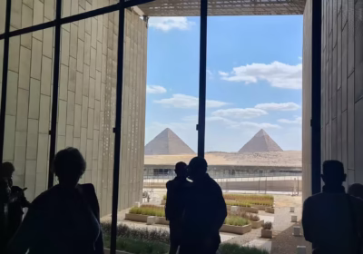
Cairo is one of the largest cities in Africa and the Arab world. It’s known for its busy streets, historic mosques, and proximity to the famous Pyramids of Giza. Walking through the city, you’ll notice a mix of ancient and modern life everywhere—from traditional markets to contemporary buildings.
If you travel south from Cairo, you’ll find more ancient sites, while heading north brings you closer to the Mediterranean coast. Many visitors also use Cairo as a starting point before heading further south to incredible landmarks like those included in the Abu Simbel Temple Tour, where Egypt’s geography and history come together in a remarkable way.

Where is Ancient Egypt Located?
Ancient Egypt was located along the Nile River, mainly in the same region as modern Egypt today. This civilization developed in the northeastern part of Africa, where the Nile provided water, fertile land, and a natural route for travel and communication.
The heart of ancient Egypt stretched from the Nile Delta in the north down to areas near Aswan in the south. Most temples, tombs, and monuments were built along this river, which is why many of the most famous sites still follow its path today. Places like Luxor and the Valley of the Kings were once central to ancient Egyptian life and power.
Many travelers don’t realize how closely modern travel routes match ancient ones. For example, experiences like the Sharm El Sheikh Camel Ride show how Egypt’s geography still shapes exploration, even far from the Nile, in areas connected to ancient trade and movement.
When you walk through temple ruins or enter a tomb, you’re standing exactly where this ancient civilization once thrived. Its location was not random—it was carefully shaped by the river, the desert, and the natural protection these landscapes provided.
Egypt’s Map
Looking at a map helps bring everything together when understanding Where’s Egypt located in the world. Egypt appears as a large country in the northeastern corner of Africa, with a distinctive shape that includes the Sinai Peninsula extending into Asia.
On most maps, the Nile River stands out clearly as it runs from south to north, ending in the wide Nile Delta along the Mediterranean Sea. This river acts like a backbone, guiding both the country’s geography and its population distribution. Major cities such as Cairo are located near this northern region, close to where the river spreads out.
You’ll also notice Egypt bordered by two major seas—the Mediterranean to the north and the Red Sea to the east. Between them lies the Suez Canal, a narrow but globally significant waterway that connects international shipping routes.
Many visitors find that studying Egypt’s map before traveling makes their journey much easier. It helps you understand distances, plan routes, and see how famous sites—from pyramids to coastal resorts—fit into the country’s overall layout.
Outline Map of Egypt
An outline map of Egypt gives a simplified view of the country’s shape, helping travelers quickly understand its borders and key regions. Instead of detailed features, it highlights the overall form—showing Egypt in the northeast of Africa with the Sinai Peninsula extending into Asia.
This type of map is especially useful for visualizing how Egypt connects to surrounding countries and seas. You can clearly see its borders with Libya to the west and Sudan to the south, along with its coastlines on both the Mediterranean and Red Seas.
One interesting way to experience this geography in real life is through the Luxor East Bank Tour, where you explore temples along the Nile while understanding how this river shaped Egypt’s layout for thousands of years.
Even a simple outline map reveals something powerful: Egypt is not isolated. Its shape reflects connection—between continents, between seas, and between ancient and modern worlds.
Top Experiences Connected to where’s Egypt located
Exploring Where’s Egypt located becomes much more meaningful when you experience it firsthand across different regions of the country. Egypt’s unique position between Africa, Asia, and two major seas creates a wide variety of travel experiences that many visitors don’t expect.
One of the most popular experiences is cruising along the Nile, where you move through the heart of ancient Egypt, passing temples in Luxor and Aswan. This journey shows how the river shaped life and civilization. On the other side of the country, the Red Sea offers a completely different atmosphere, with crystal-clear waters and vibrant marine life perfect for diving and relaxation.
For those curious about where egypt located in africa, visiting desert landscapes like the Western Desert or Sinai gives a deeper understanding of Egypt’s vast and varied terrain. These areas reveal how much of the country lies beyond the green Nile Valley.
Many travelers are surprised by how diverse Egypt feels in one trip. From historical monuments to coastal resorts and desert adventures, its location allows you to experience multiple worlds in a single journey—something few destinations can offer.
Best Tours to Explore Egypt’s Location and Landmarks
To truly understand Egypt’s geography, joining guided tours can make a big difference. Seeing the country on a map is one thing, but traveling through its regions brings where’s egypt located to life in a much deeper way.
One of the best ways to experience this is by exploring Upper Egypt along the Nile. Journeys between cities like Luxor and Aswan reveal how ancient sites are connected by the river. At the same time, coastal destinations on the Red Sea offer a completely different perspective, showing how Egypt stretches between diverse environments.
For a unique experience beyond the Nile, you can try the Sharm El Sheikh Camel Ride, where the desert landscape highlights Egypt’s position near Asia and the Red Sea. It’s a simple activity, but it gives you a real sense of the land.
Another must-do is the Luxor East Bank Tour, where you walk among massive temple complexes that were built along the Nile thousands of years ago. These tours help you understand not just history, but how geography shaped everything—from settlement to culture—across Egypt.”